
Saturday 11 May 2024 at 10:45
Giro d'Italia '24 / Stage 8
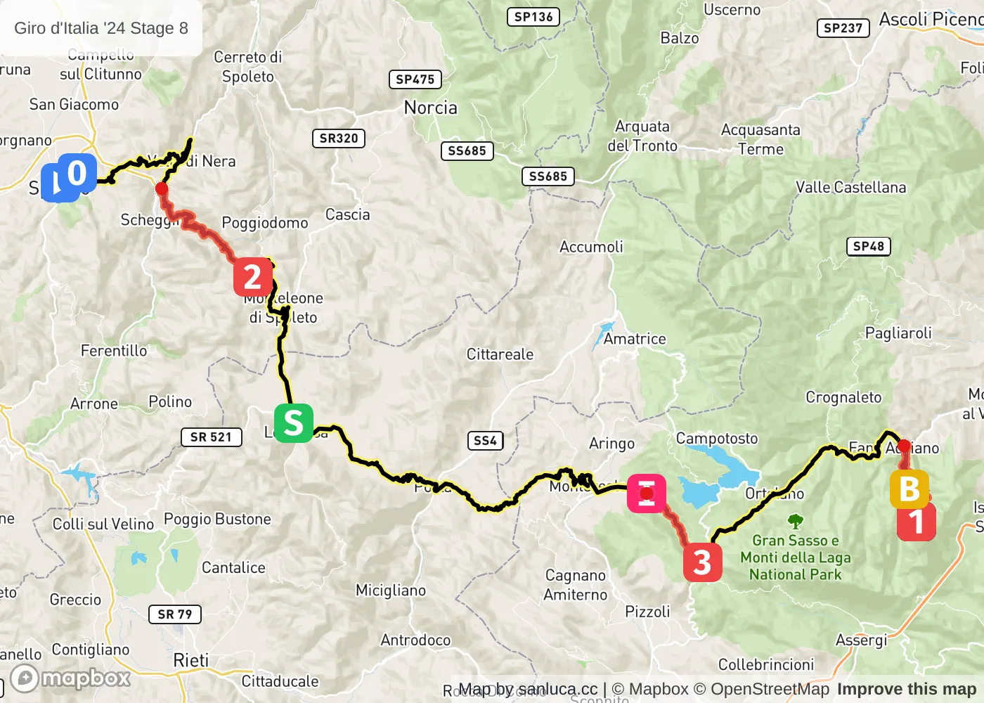
Spoleto - Prati di Tivo
Classification: 2.UWT - Category ME
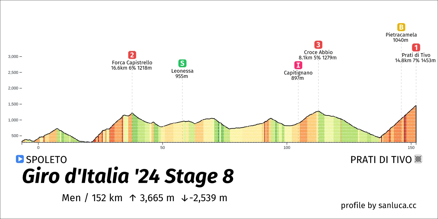
The stage
Stage 8 of the 2024 Giro d'Italia is a mountain stage that will take place on Saturday 11 May 2024 at 10:45.The stage starts in Spoleto and finishes in Prati di Tivo. Start time is 10:45 with an expected finish at 15:12 (average speed of 34 km/h).
The total distance of the stage is 151.8 km. The stage includes 3 categorized climbs and 1 intermediate sprint. The stage has a total elevation gain of 3471.2 m with the highest altitude of the stage being 1428 m. The total descent of the stage is -2474.1 m.
Weather and forecast
No weather data available
Points of interest
The stage includes 3 categorized climbs and 1 intermediate sprint.
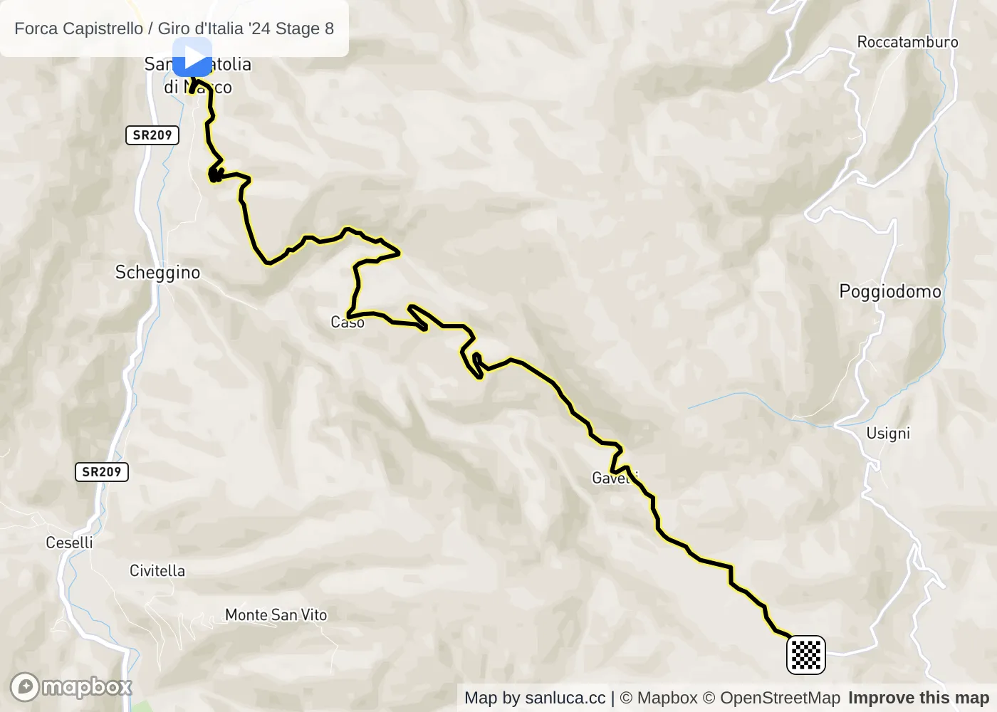
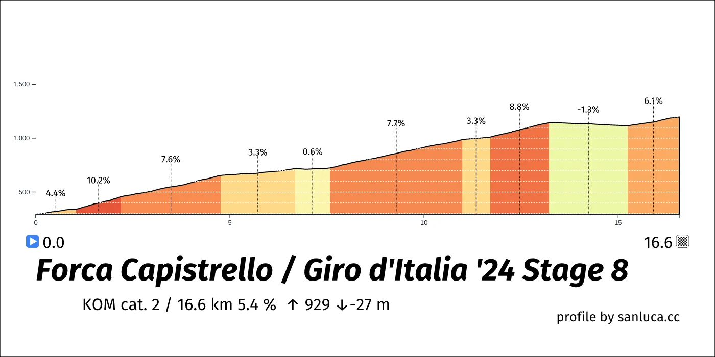
Forca Capistrello
Forca Capistrello is a KOM cat. 2 climb, which starts at 20.9 km (130.9 km to go) and ends at 37.5 km (114.3 km to go). It has total distance of 16.6 km, and an average gradient of 5.4%, going from 294 to 1196 meters of altitude.
Leonessa
Leonessa is a Sprint at 57.9 km (93.8 km to go).
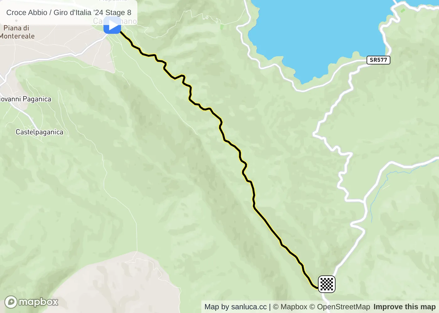
Croce Abbio
Croce Abbio is a KOM cat. 3 climb, which starts at 104.4 km (47.4 km to go) and ends at 112.5 km (39.3 km to go). It has total distance of 8.1 km, and an average gradient of 4.6%, going from 894 to 1267 meters of altitude.

Capitignano
Capitignano is a Intergiro at 104.4 km (47.4 km to go).
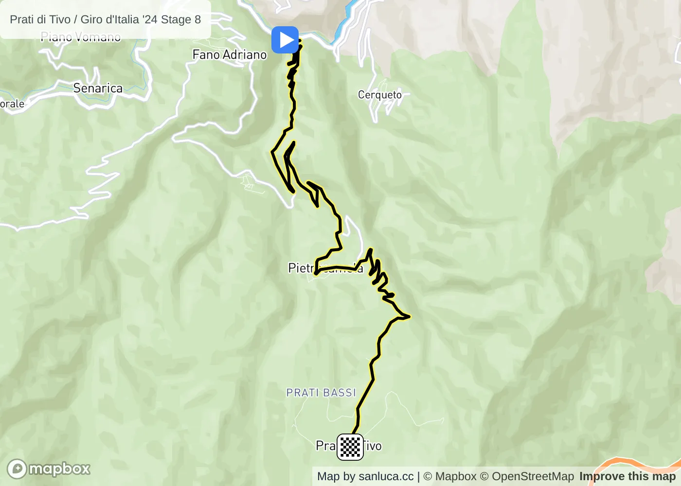
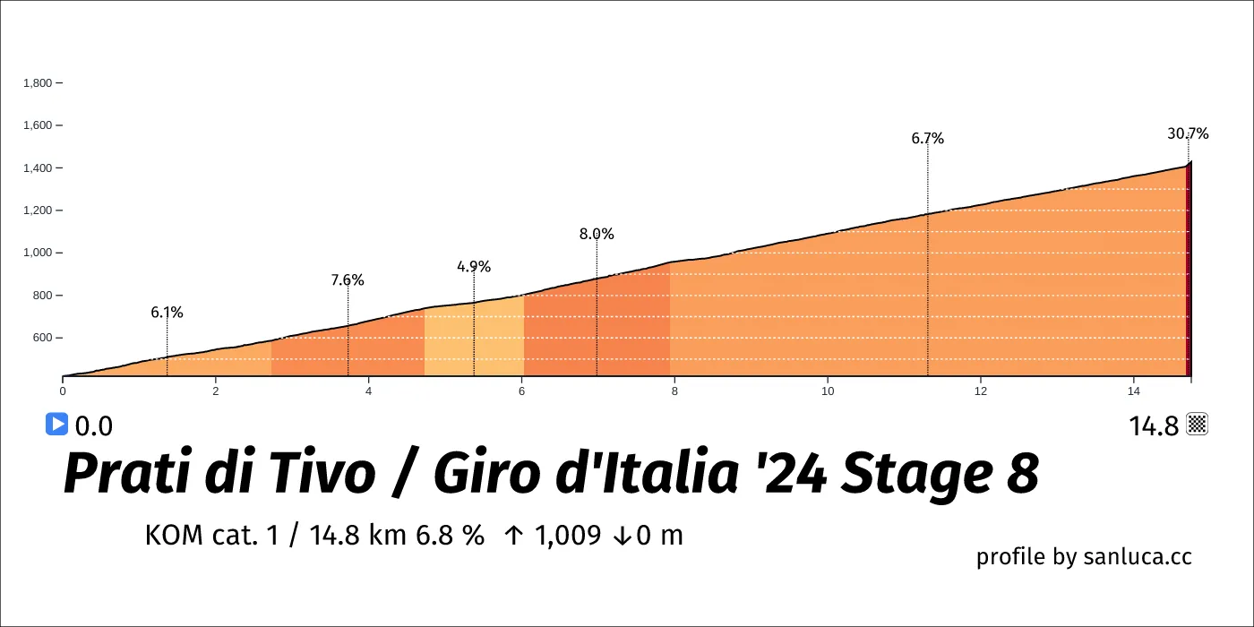
Prati di Tivo
Prati di Tivo is a KOM cat. 1 climb, which starts at 137 km (14.8 km to go) and ends at 151.8 km (0 km to go). It has total distance of 14.8 km, and an average gradient of 6.8%, going from 420 to 1428 meters of altitude.
Pietracamela
Pietracamela is a Bonus sprint at 145.9 km (5.9 km to go).
Final 3k
The final 3 km for this stage starts at 148.8 km, has an average gradient of 7.3%, and reaching 1428 m of altitude.

