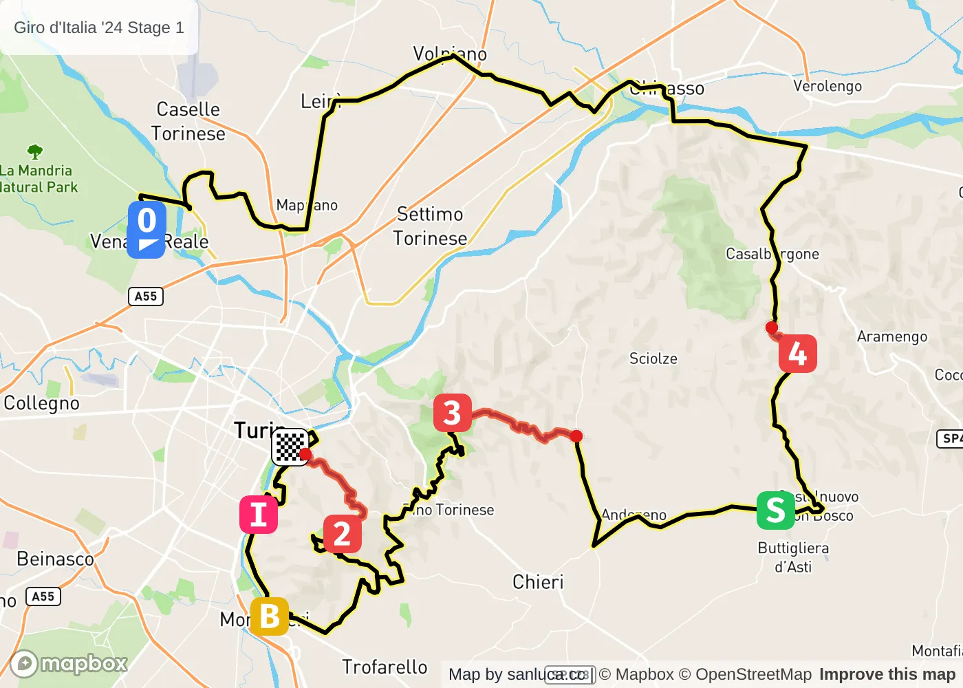
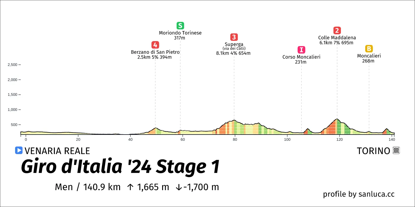
- Total distance: 139.2 km
- Type: Medium Mountain
- Ascent: 1668.1 m
- Descent: -1697.9 m
- Date: May 4
- Start time: 11:55
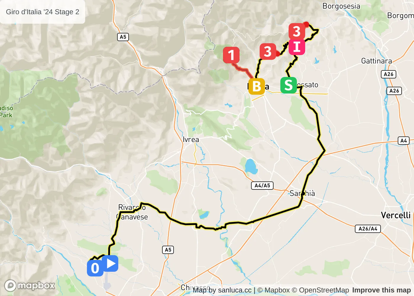
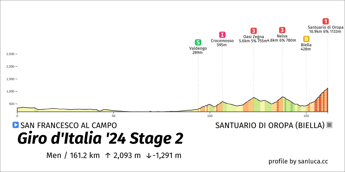
- Total distance: 161.2 km
- Type: Hilly
- Ascent: 2092.6 m
- Descent: -1291.5 m
- Date: May 5
- Start time: 11:05
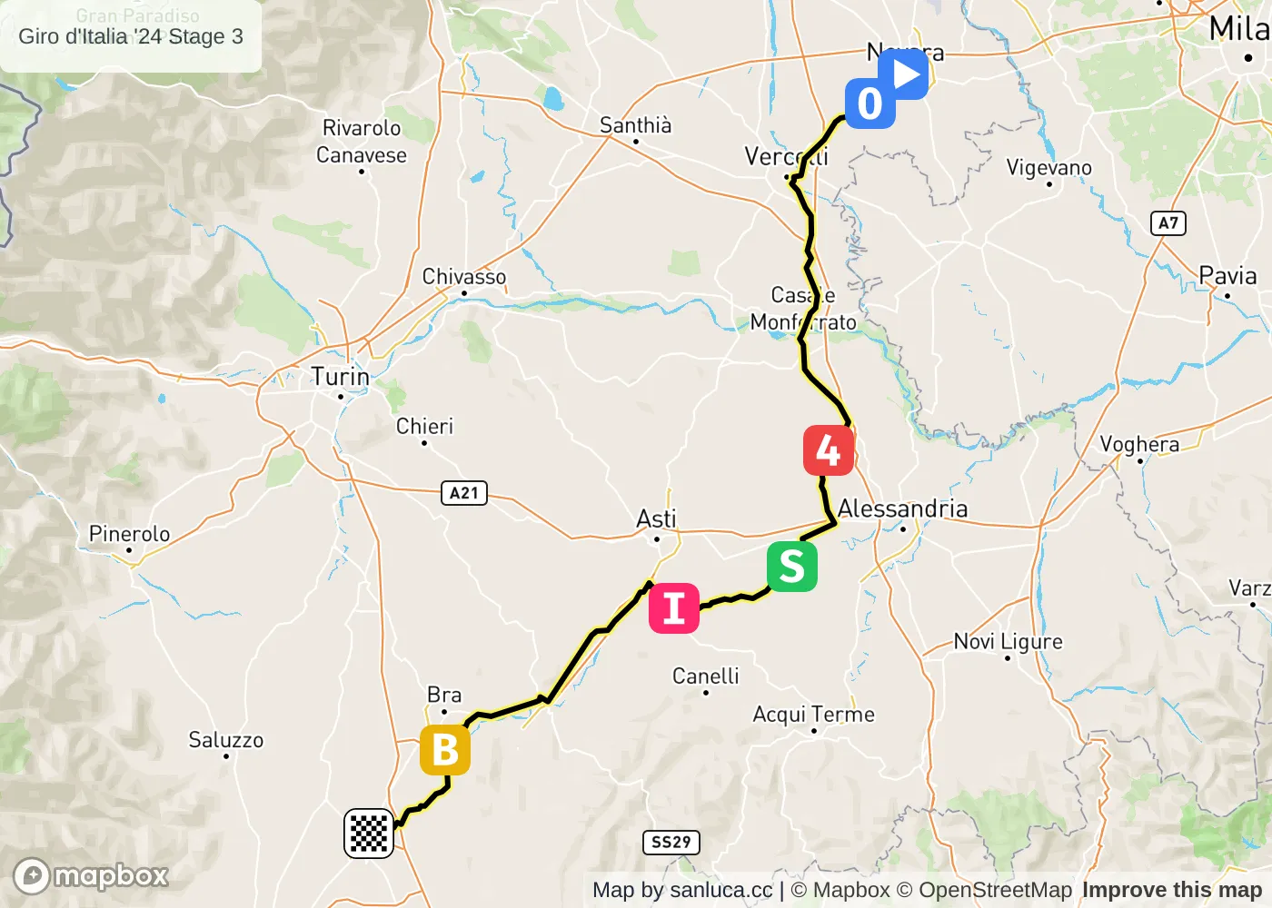
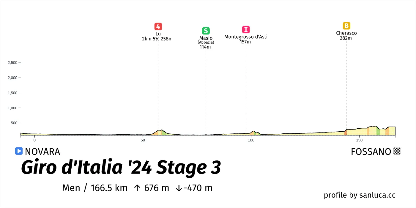
- Total distance: 166.4 km
- Type: Hilly
- Ascent: 720.8 m
- Descent: -489.6 m
- Date: May 6
- Start time: 11:25
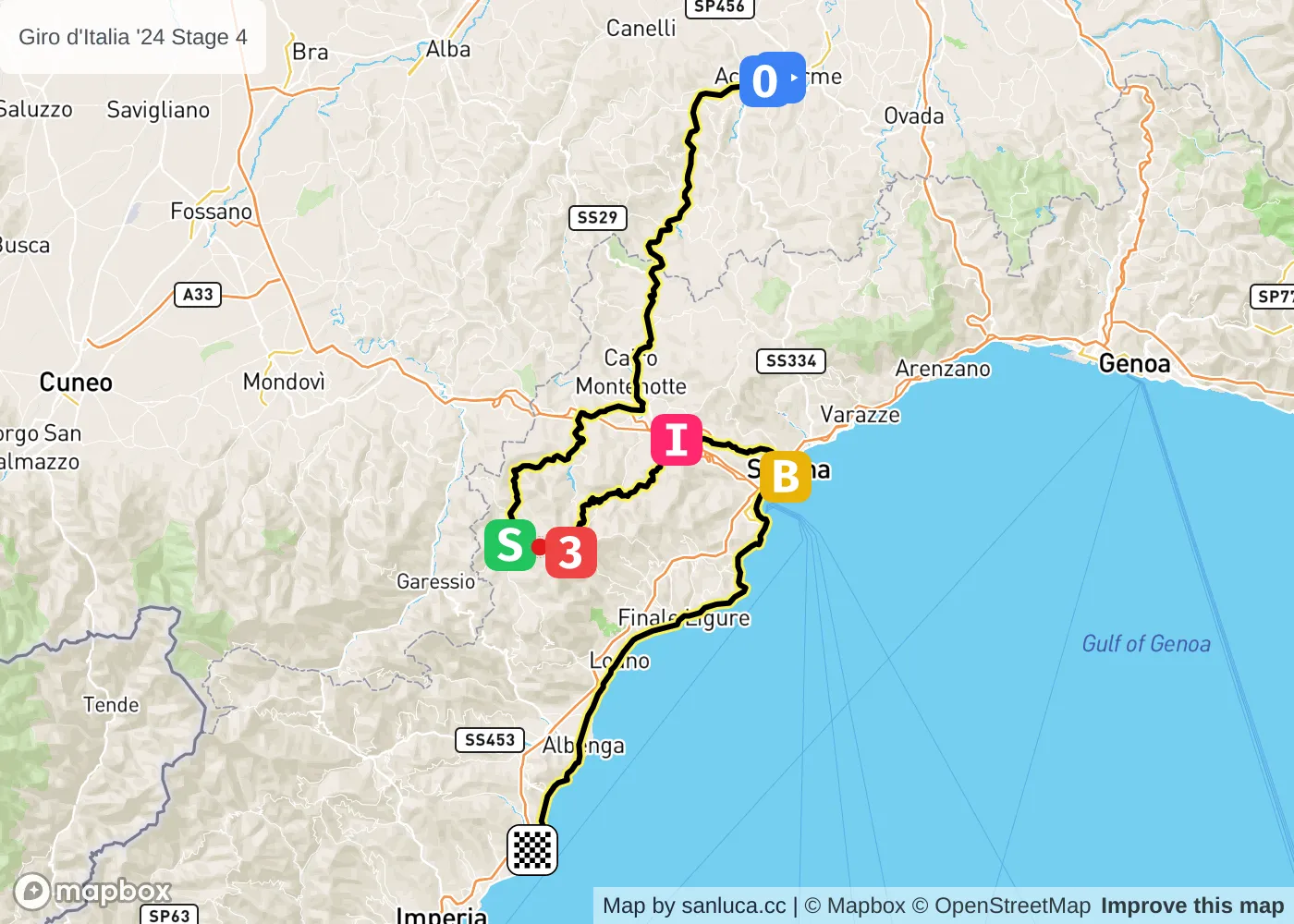
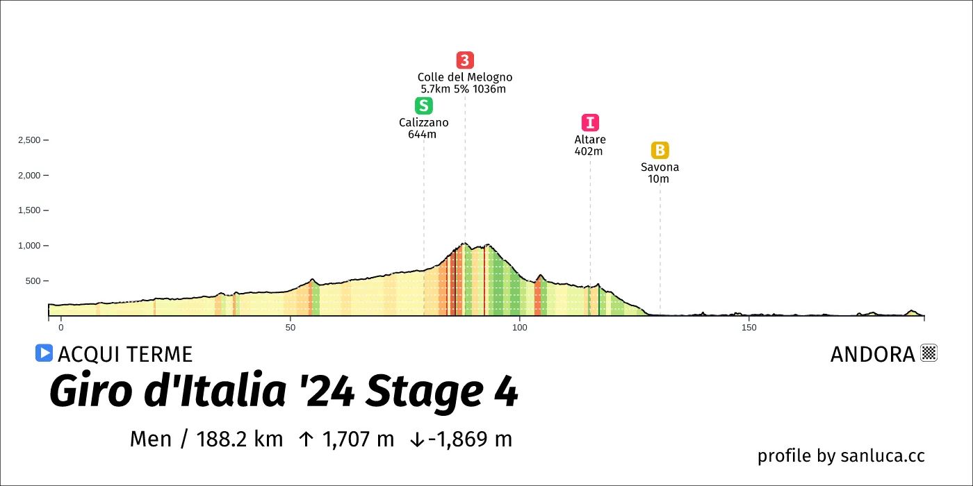
- Total distance: 189.9 km
- Type: Hilly
- Ascent: 1452.7 m
- Descent: -1606.9 m
- Date: May 7
- Start time: 10:35
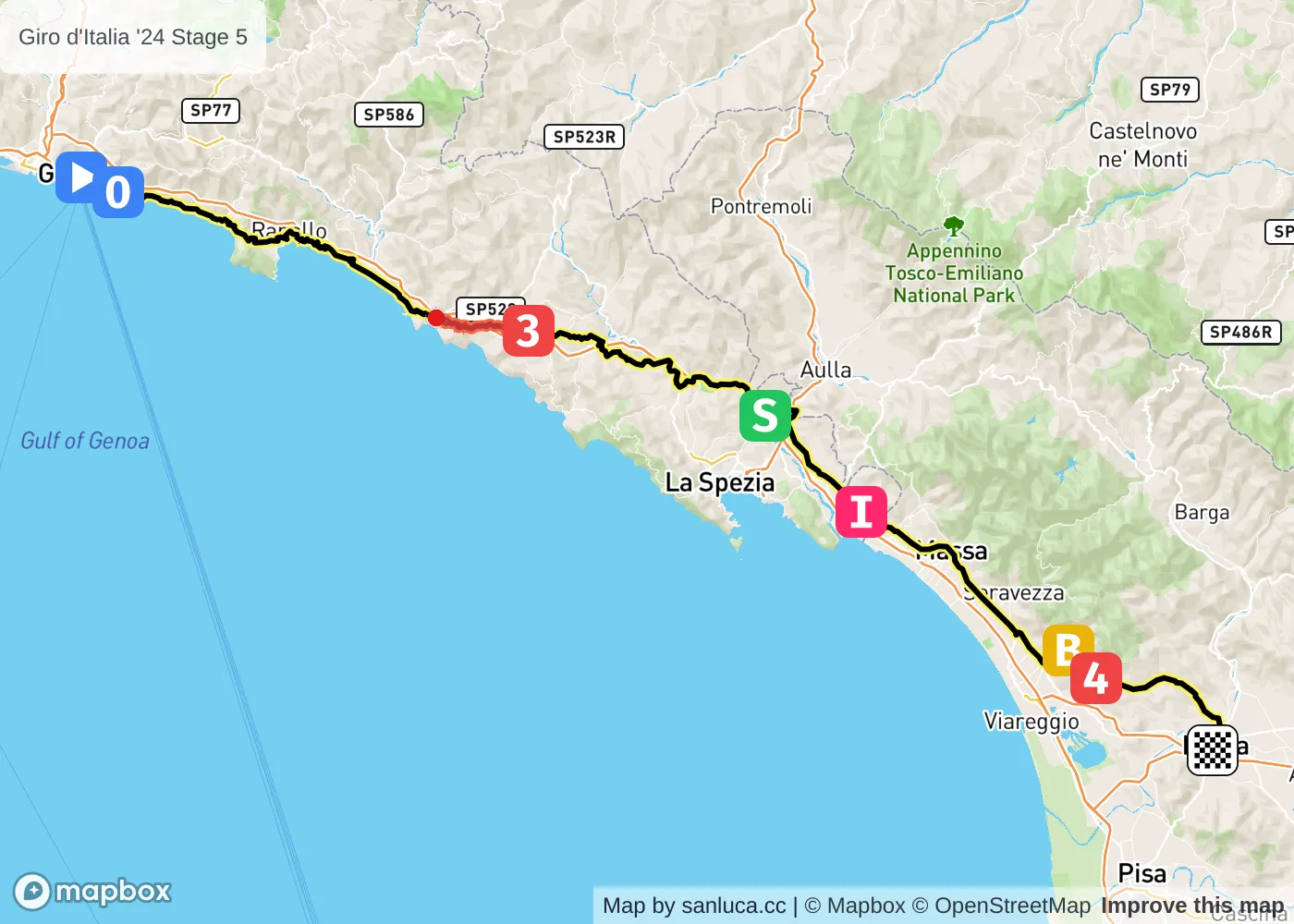
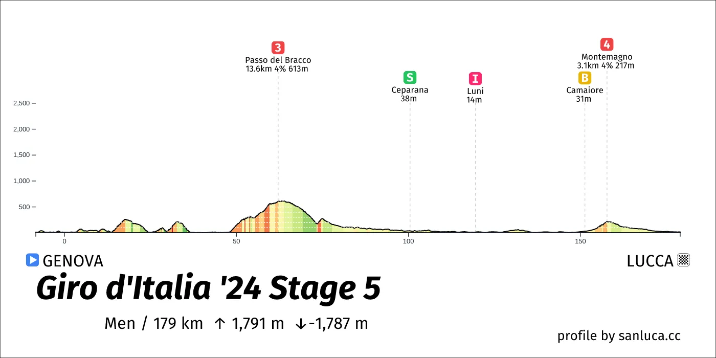
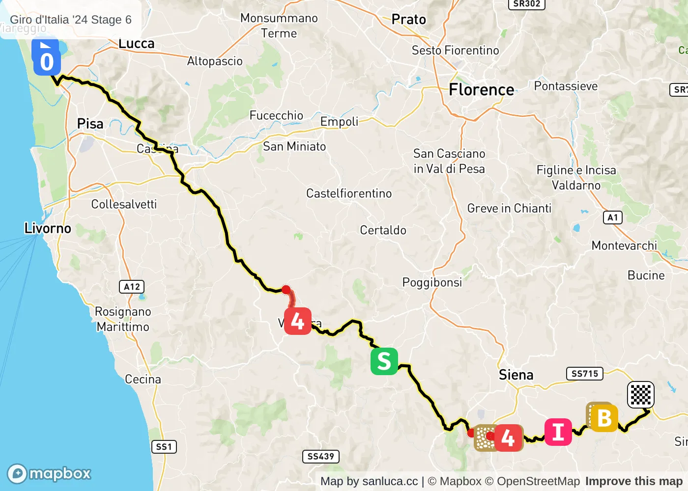
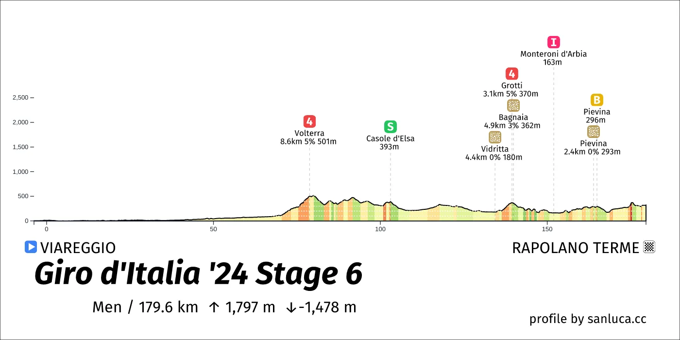
- Total distance: 177.6 km
- Type: Hilly
- Ascent: 1663 m
- Descent: -1662.1 m
- Date: May 8
- Start time: 11:00
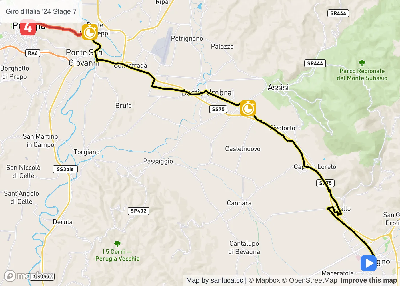
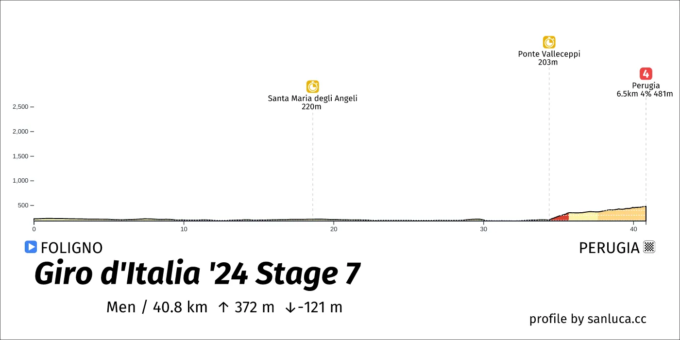
- Total distance: 180 km
- Type: Hilly
- Ascent: 1916.6 m
- Descent: -1597.3 m
- Date: May 9
- Start time: 10:55
- Total distance: 40.7 km
- Type: Flat
- Ascent: 381.4 m
- Descent: -136.4 m
- Date: May 10
- Start time: 11:00
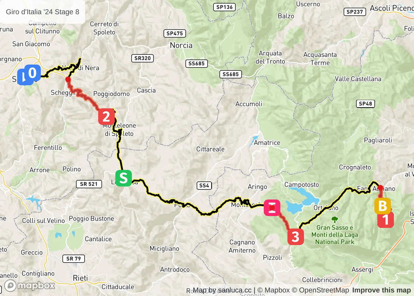
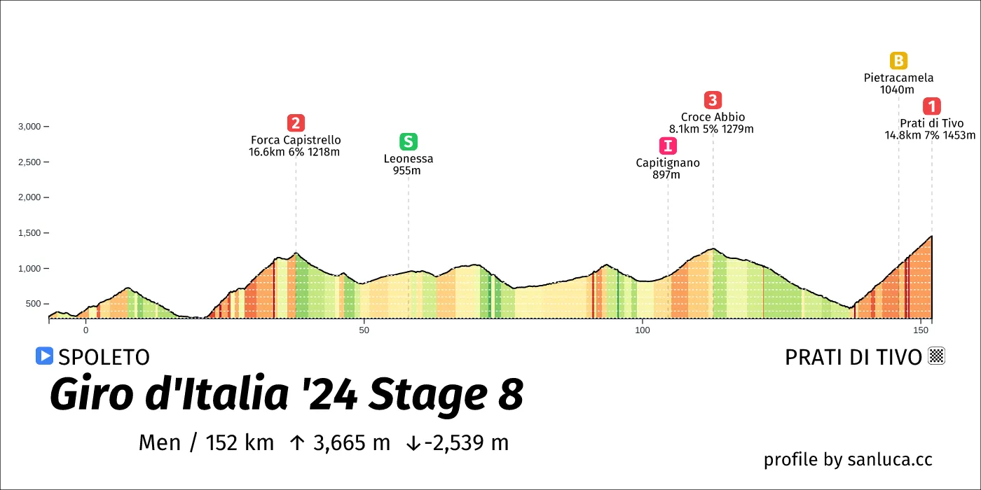
- Total distance: 151.8 km
- Type: Mountain
- Ascent: 3471.2 m
- Descent: -2474.1 m
- Date: May 11
- Start time: 10:45
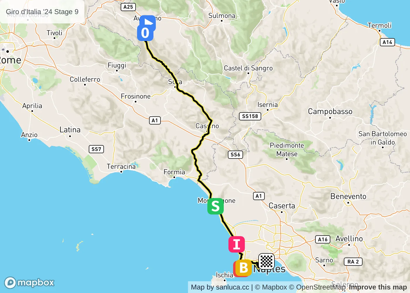
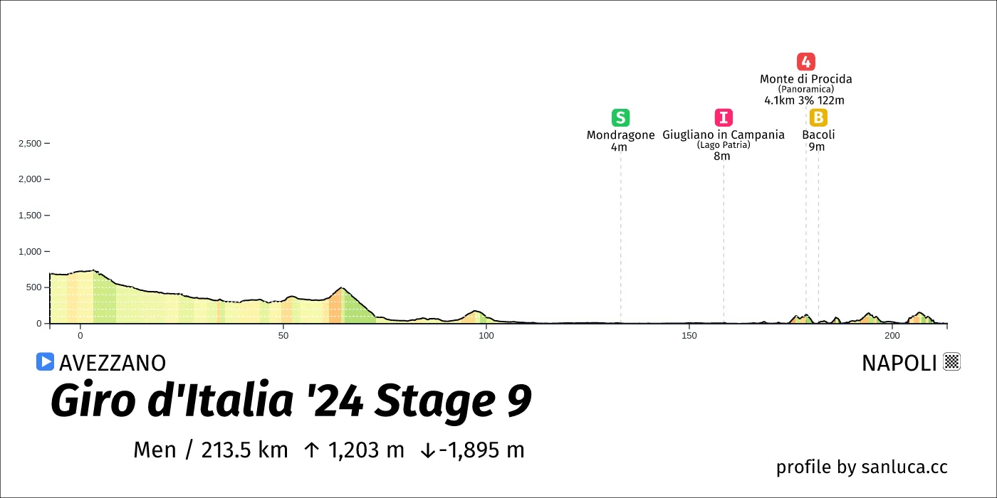
- Total distance: 213.5 km
- Type: Lumpy
- Ascent: 1214 m
- Descent: -1930.1 m
- Date: May 12
- Start time: 10:15
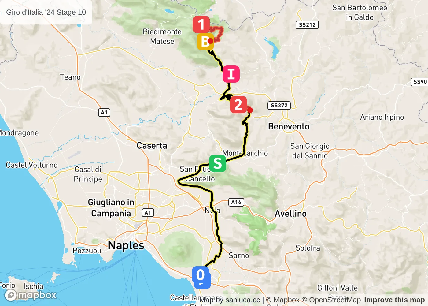
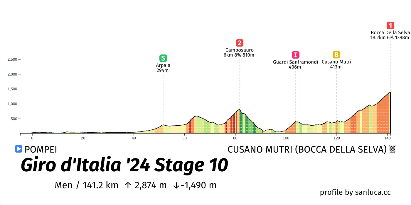
- Total distance: 141.6 km
- Type: Medium Mountain
- Ascent: 2836.5 m
- Descent: -1505.8 m
- Date: May 14
- Start time: 11:15
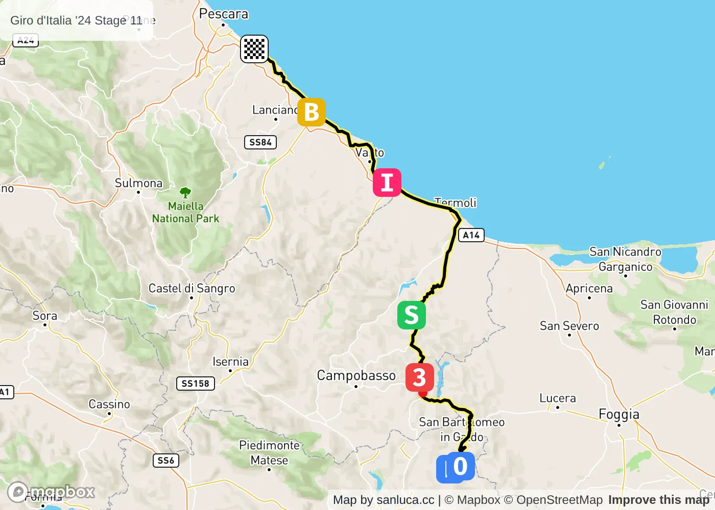
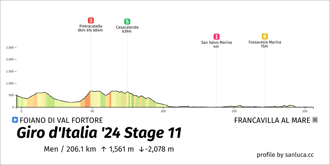
- Total distance: 207.1 km
- Type: Hilly
- Ascent: 1495.8 m
- Descent: -1903 m
- Date: May 15
- Start time: 10:15
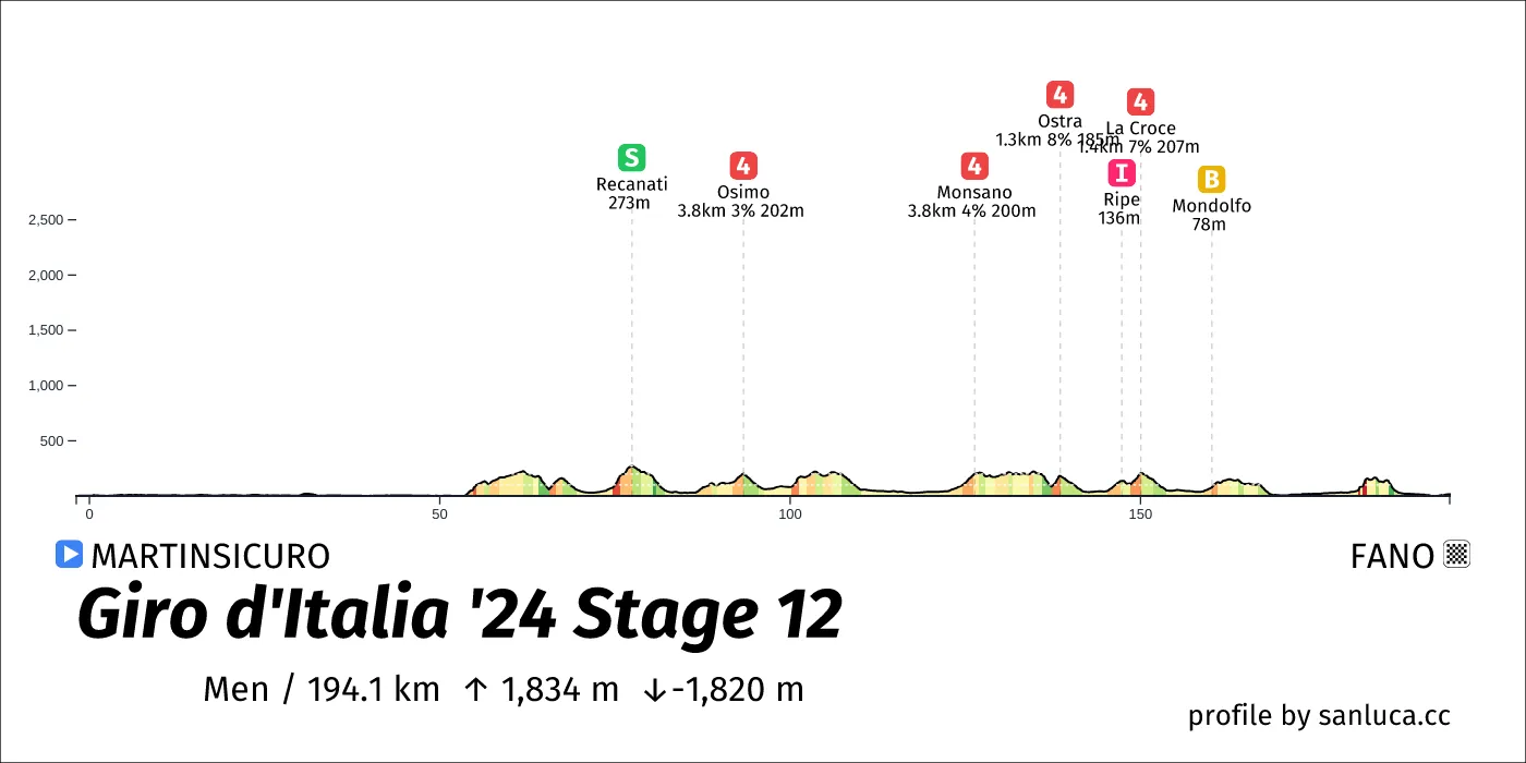
- Total distance: 193.1 km
- Type: Hilly
- Ascent: 1917.6 m
- Descent: -1906.4 m
- Date: May 16
- Start time: 10:30
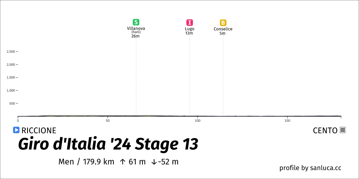
- Total distance: 179.9 km
- Type: Flat
- Ascent: 60.7 m
- Descent: -52 m
- Date: May 17
- Start time: 11:10
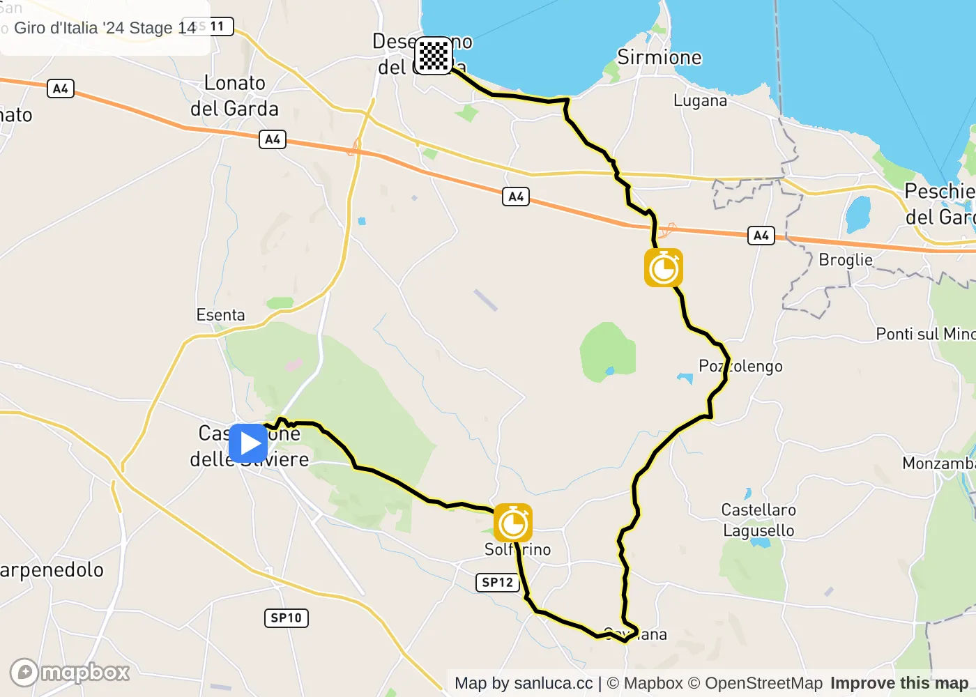
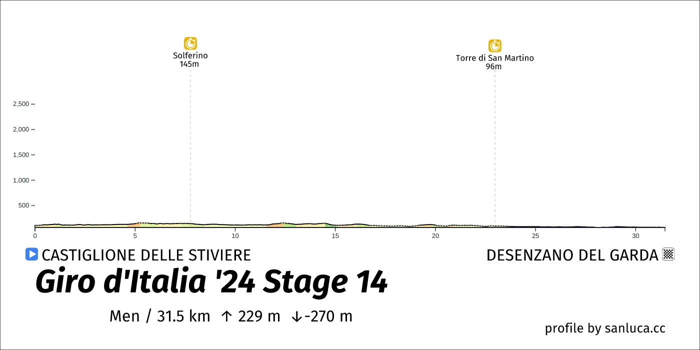
- Total distance: 31.2 km
- Type: Flat
- Ascent: 196.1 m
- Descent: -233.5 m
- Date: May 18
- Start time: 11:20
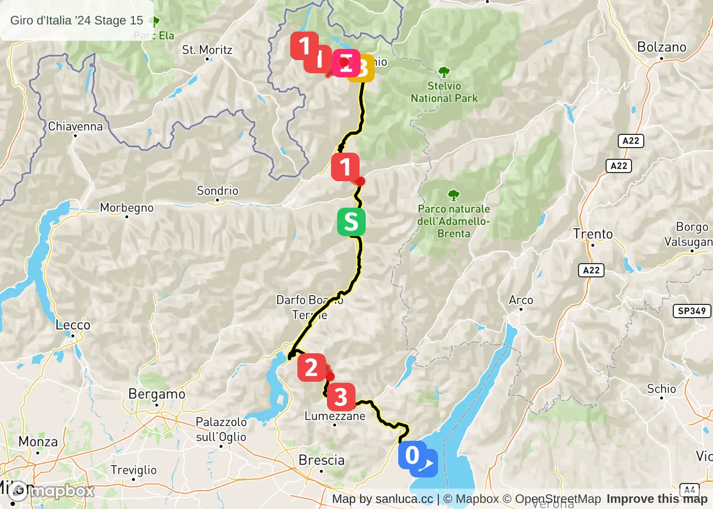
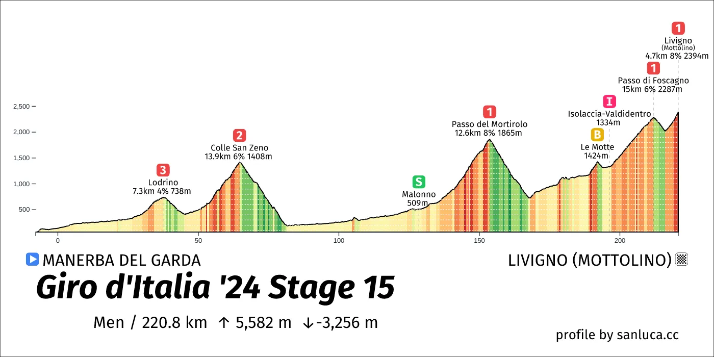
- Total distance: 221.8 km
- Type: Mountain
- Ascent: 5383.1 m
- Descent: -3144 m
- Date: May 19
- Start time: 08:40
- Total distance: 206.8 km
- Type: Mountain
- Ascent: 3633.4 m
- Descent: -3909.7 m
- Date: May 21
- Start time: 09:35
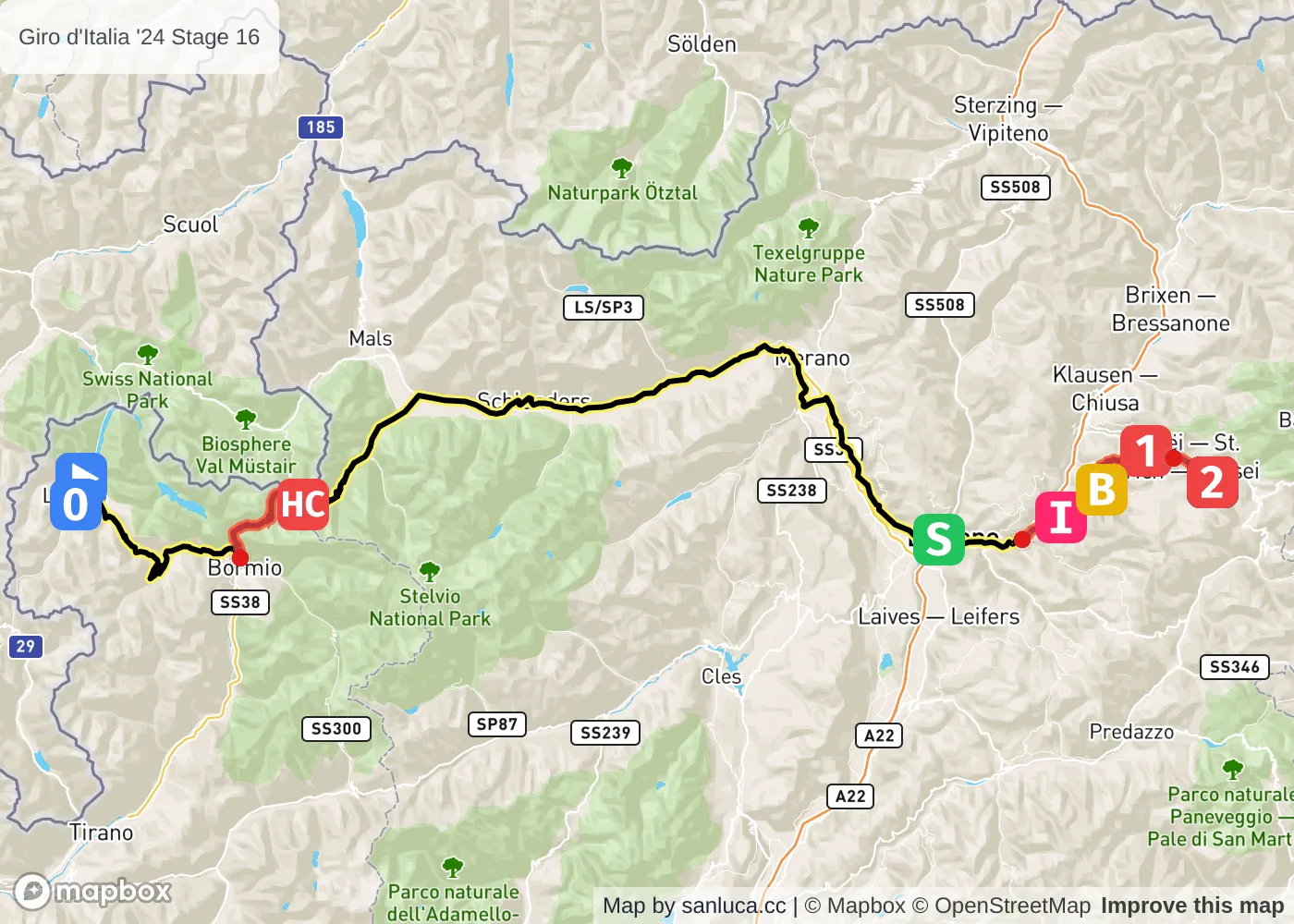
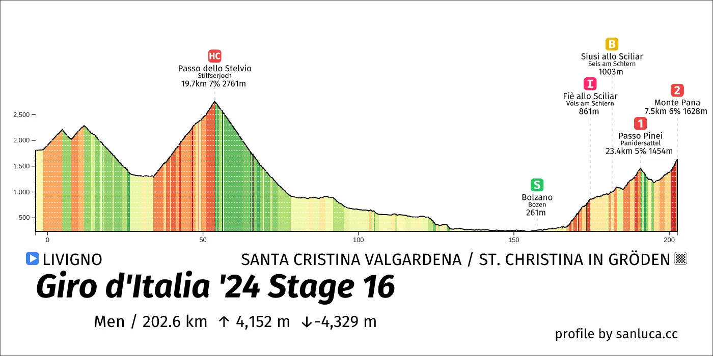
- Total distance: 158.8 km
- Type: Mountain
- Ascent: 3893.4 m
- Descent: -3873.3 m
- Date: May 22
- Start time: 10:30
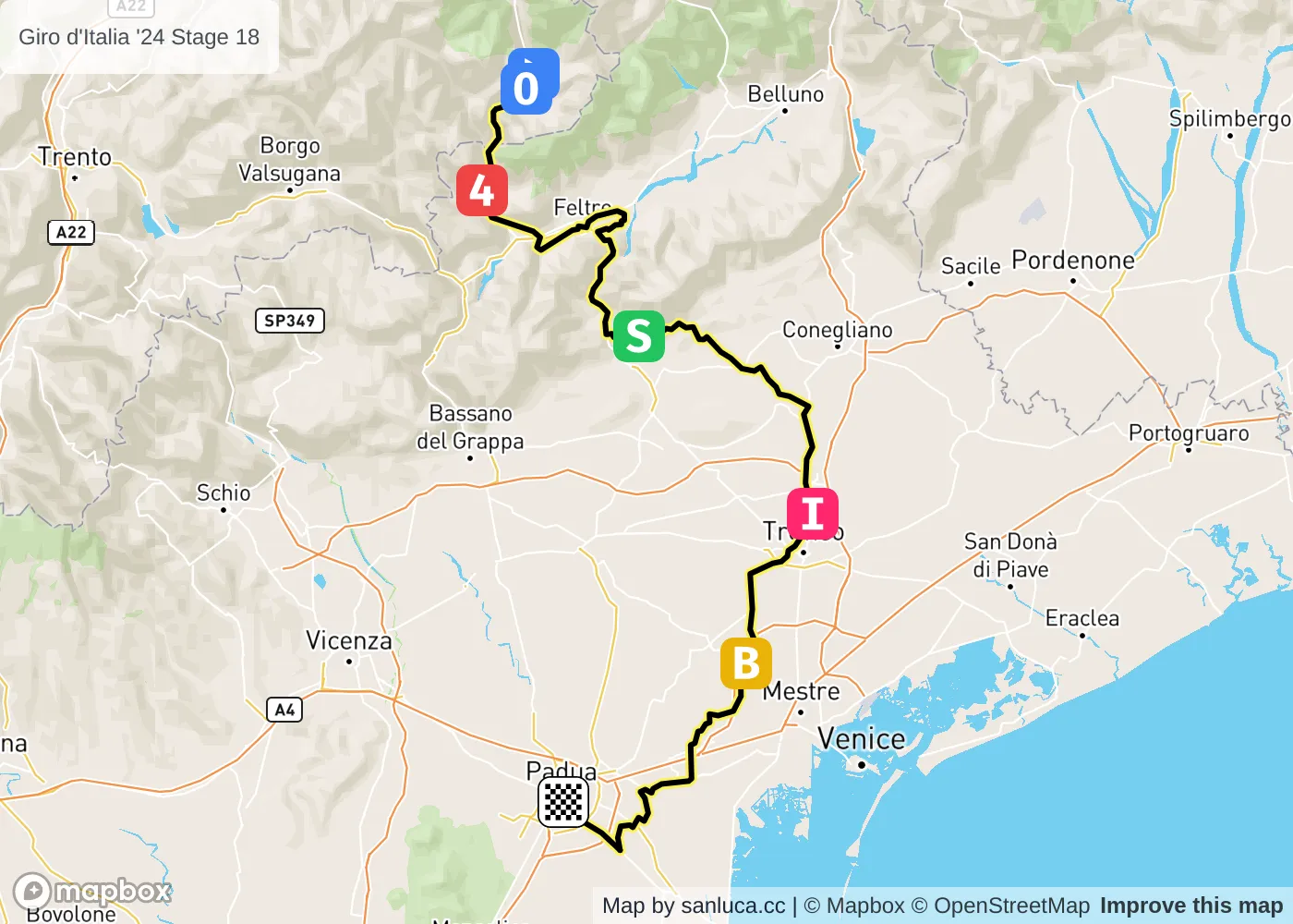
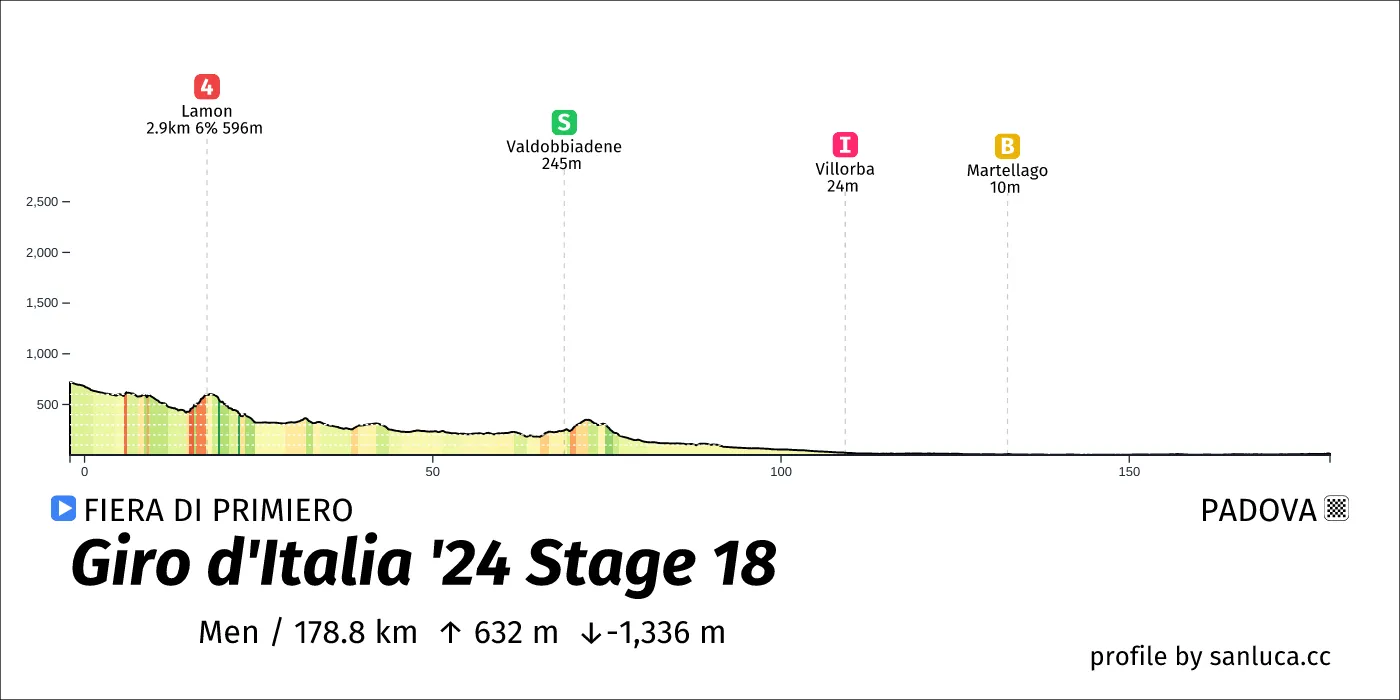
- Total distance: 178.4 km
- Type: Lumpy
- Ascent: 682.9 m
- Descent: -1346.3 m
- Date: May 23
- Start time: 11:10
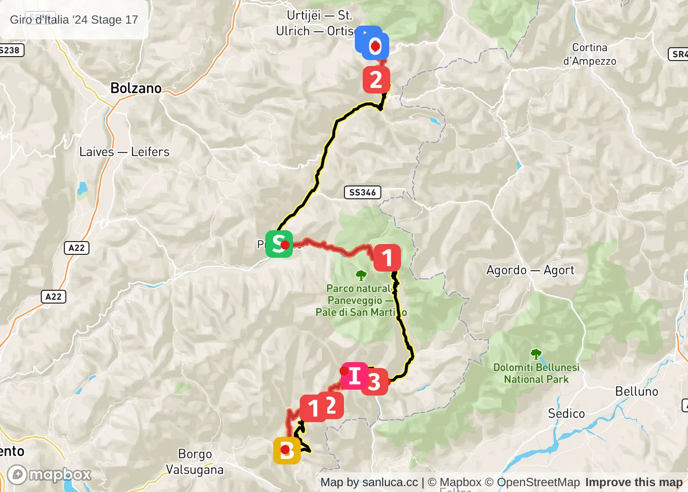
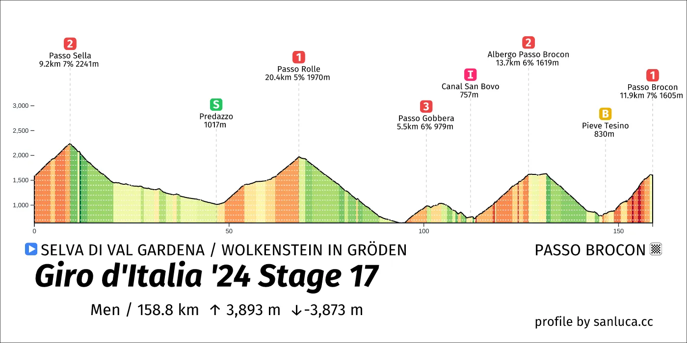
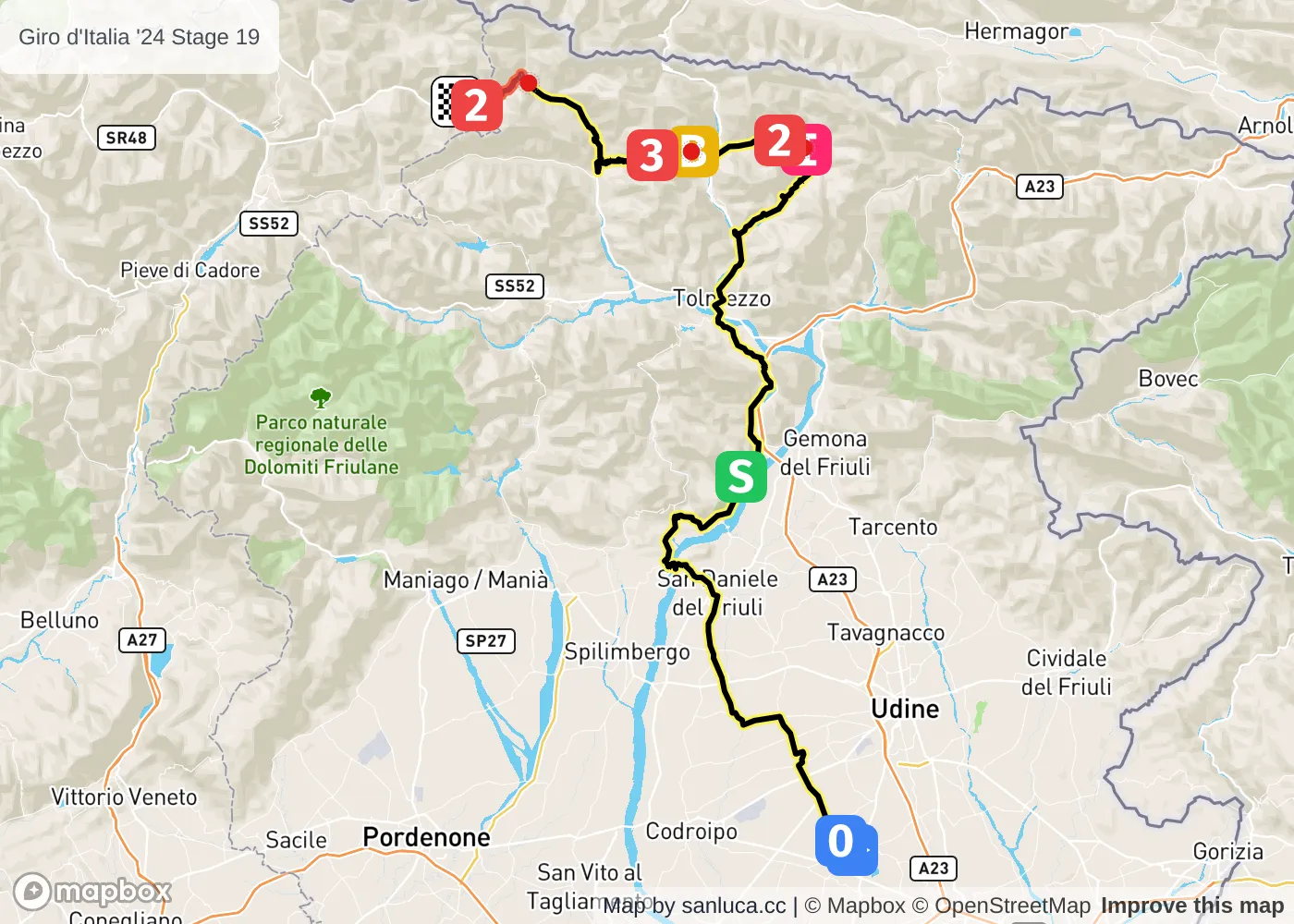
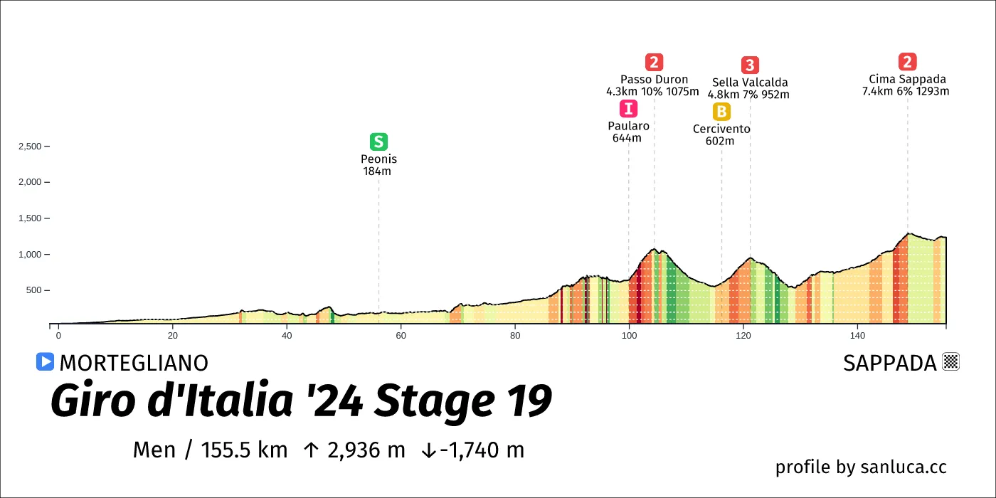
- Total distance: 157.6 km
- Type: Medium Mountain
- Ascent: 2882.2 m
- Descent: -1687 m
- Date: May 24
- Start time: 11:10
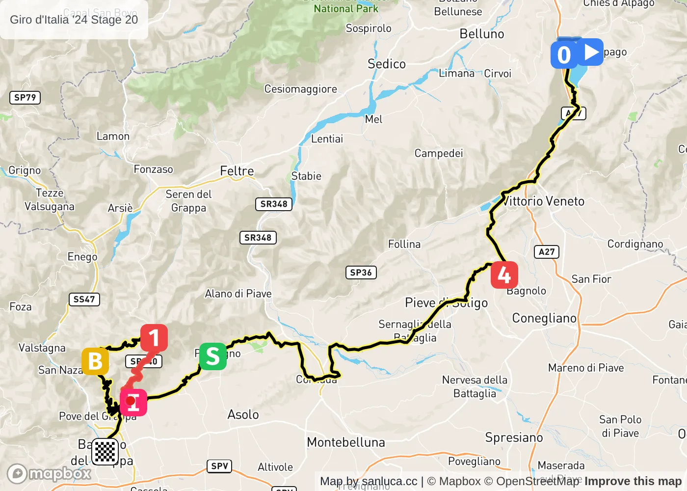
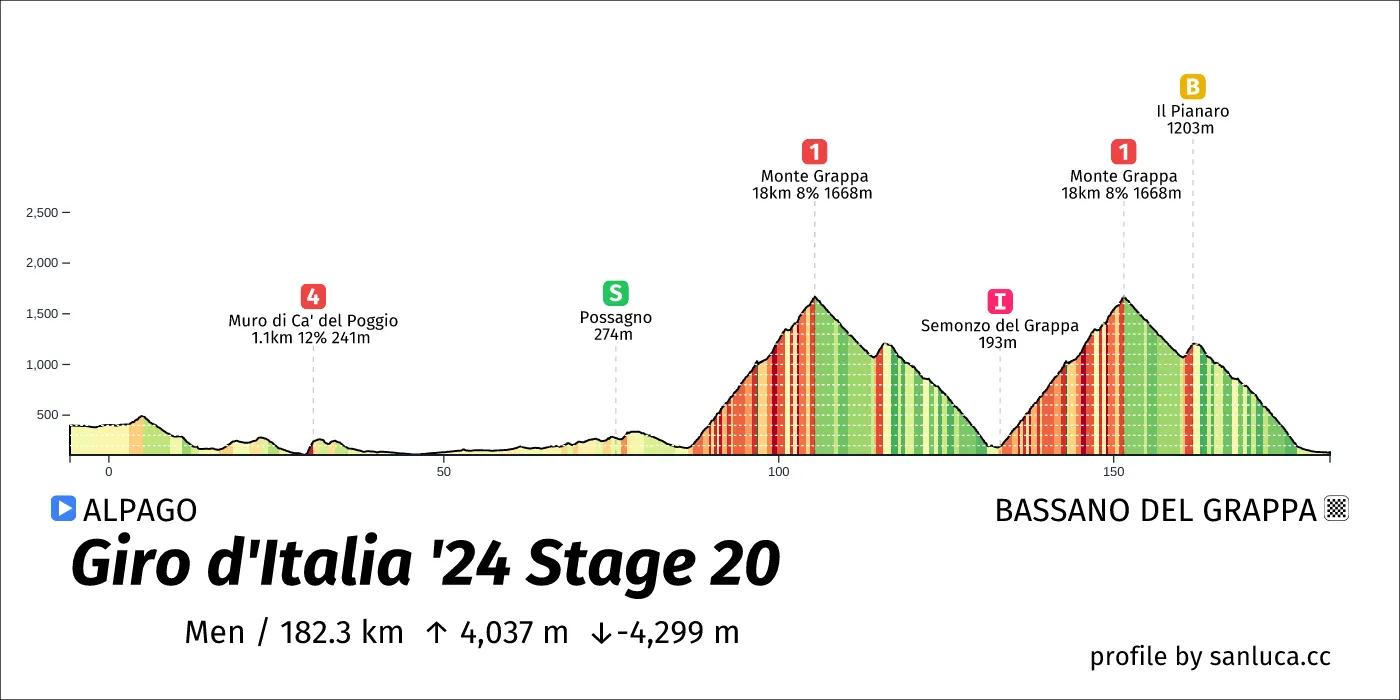
- Total distance: 184.3 km
- Type: Mountain
- Ascent: 4031.7 m
- Descent: -4296.2 m
- Date: May 25
- Start time: 09:50
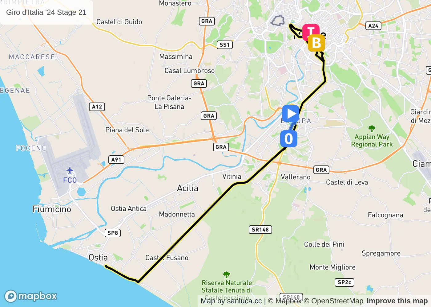
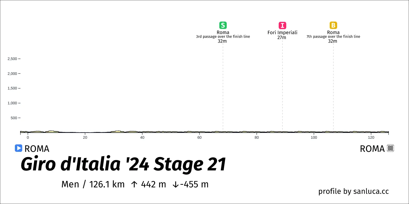
- Total distance: 125 km
- Type: Flat
- Ascent: 458.2 m
- Descent: -450.2 m
- Date: May 26
- Start time: 13:35